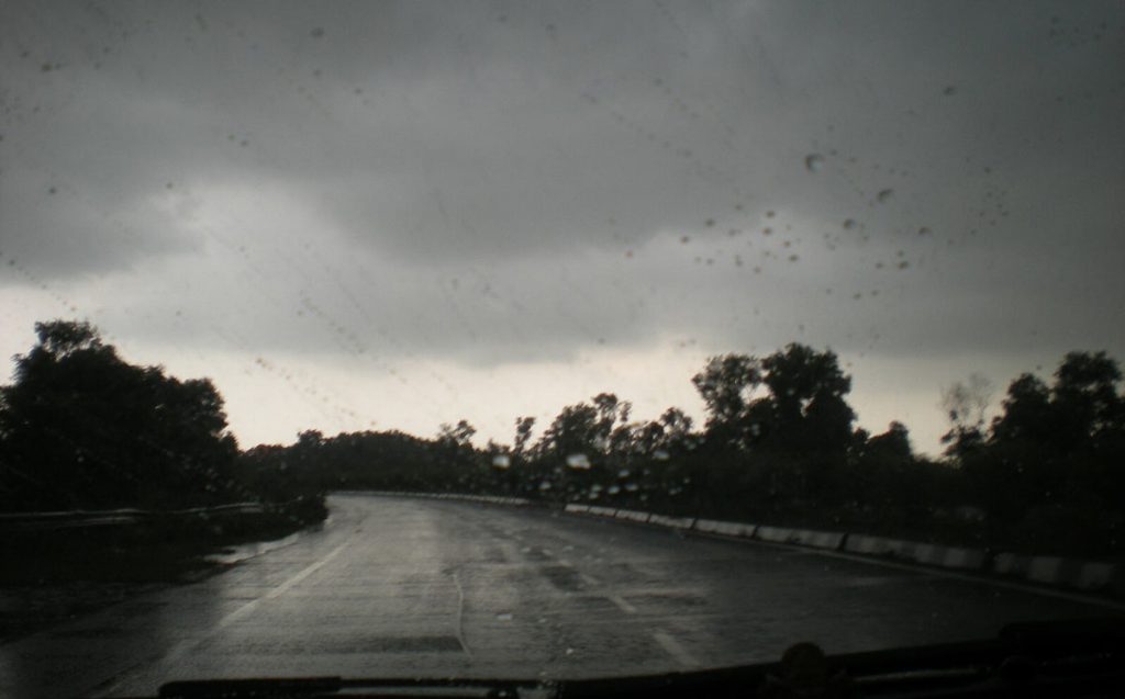
Andhra Pradesh is grappling with intense rainfall as a reinvigorated southwest monsoon, driven by a low-pressure system over the Bay of Bengal, batters several parts of the state. On June 12, 2025, the India Meteorological Department (IMD) issued orange and yellow alerts for multiple districts, forecasting heavy to very heavy rainfall, thunderstorms, and gusty winds across Coastal Andhra Pradesh, Yanam, and Rayalaseema through June 17.
The active monsoon phase has disrupted daily life, prompting authorities to heighten preparedness to mitigate potential flooding and related risks.
Monsoon revival prompts weather alerts
The IMD’s press release highlighted an active monsoon phase over south peninsular India, with Andhra Pradesh among the worst-affected regions. A low-pressure system, which entered the Andhra Pradesh coast and moved toward North Rayalaseema, is expected to reach coastal Karnataka by June 13. This system has triggered widespread rainfall, with isolated areas likely to experience extremely heavy downpours.
Significant rainfall was recorded on June 11, with Machilipatnam (Krishna district) receiving 6 cm, Vijayawada-Gannavaram (Krishna) and Kalingapatnam (Srikakulam) each recording 2 cm, and Amaravati (Guntur) receiving 1 cm between 8:30 AM and 5:30 AM IST. The IMD has warned of gusty winds reaching speeds of 50–60 km/h in isolated areas, particularly in North Coastal Andhra Pradesh (NCAP) and Rayalaseema, while South Coastal Andhra Pradesh (SCAP) could see winds of 40–50 km/h.
Orange alerts have been issued for districts including Visakhapatnam, Anakapalli, Kakinada, Nellore, and Tirupati, anticipating heavy to very heavy rainfall. Yellow alerts cover Krishna, Bapatla, Prakasam, and Vizianagaram, where heavy rainfall is expected. Squally weather with wind speeds of 35–45 km/h, gusting up to 55 km/h, is forecast along the coast, prompting advisories for fishermen to remain ashore due to rough sea conditions.
Rains affect daily life in Andhra Pradesh
The heavy rains have already caused disruptions across the state. In Vijayawada, Guntur, and other coastal districts, roads have been inundated, affecting vehicular movement. Low-lying areas in Krishna and NTR districts are at risk of waterlogging, with authorities closely monitoring water bodies to prevent flash floods.
In Rayalaseema, districts like Anantapur, Kurnool, and Sathya Sai are bracing for intense showers, a rare occurrence for the region in June, as the low-pressure system moves inland.
The Andhra Pradesh State Disaster Management Authority (APSDMA) has issued a high alert, urging residents to avoid crossing streams or canals during heavy rainfall. Chief Minister Chandrababu Naidu has directed district administrations to remain vigilant, with special emphasis on monitoring rivers and reservoirs. The Central Water Commission (CWC) has warned of potential swelling in rivers such as Godavari and Krishna, advising controlled water discharges from projects like Nagarjunasagar and Srisailam.
In response to the weather conditions, schools and colleges in flood-prone districts like Nellore and Tirupati have been closed as a precautionary measure. National Disaster Response Force (NDRF) and State Disaster Response Force (SDRF) teams are on standby in high-risk areas to handle emergencies.
Agricultural and economic implications
The monsoon’s revival is a double-edged sword for Andhra Pradesh. While the rainfall is critical for replenishing water supplies and supporting kharif sowing, excessive downpours pose risks to crops and infrastructure. Farmers in coastal districts, particularly those cultivating paddy, have been advised to take precautions to protect their fields from waterlogging. The heavy rains come after a summer of excess rainfall in parts of the state, with Amaravati recording 404 mm and Anantapur 284 mm between March and May 2025, according to IMD data.
The state’s agricultural sector, a key driver of Andhra Pradesh’s economy, relies heavily on timely monsoon rains. However, the IMD’s forecast of above-normal rainfall in June, potentially exceeding 108% of the long-period average of 166.9 mm, raises concerns about potential flooding in low-lying areas. Authorities are hopeful that the rains will replenish reservoirs, which had been depleted during a dry spell in late May.
Government response
Chief Minister Chandrababu, during a review meeting on June 12, emphasized proactive measures to minimize loss of life and property. He instructed officials to send real-time alerts to residents’ mobile phones and ensure coordination between departments, including police, irrigation, and disaster management.
The APSDMA has also closed flood-prone roads and suspended tourist activities in areas like Rampachodavaram (Alluri Sitarama Raju district) until conditions stabilize.
Local communities are adapting to the deluge, with residents in urban centers like Vijayawada and Visakhapatnam urged to stay indoors during peak rainfall hours.
Monsoon surge
The heavy rains in Andhra Pradesh are part of a broader monsoon surge across south peninsular India, with neighboring states like Karnataka, Tamil Nadu, and Kerala also experiencing intense rainfall. The IMD attributed this to cyclonic circulations over the Bay of Bengal and favorable conditions in the Arabian Sea. The monsoon, which had stalled around May 29, resumed its northward progression on June 12, bringing much-needed relief to parched regions but also raising flood risks in coastal and low-lying areas.
The IMD forecasts that rainfall activity will remain intense through June 17, with Coastal Andhra Pradesh and Yanam likely to see heavy showers on June 13 and 14. Rayalaseema may experience a brief respite by June 15, but isolated thunderstorms are expected to persist. Authorities are particularly concerned about districts like West Godavari, Eluru, and Krishna, which are prone to flooding during such weather events.